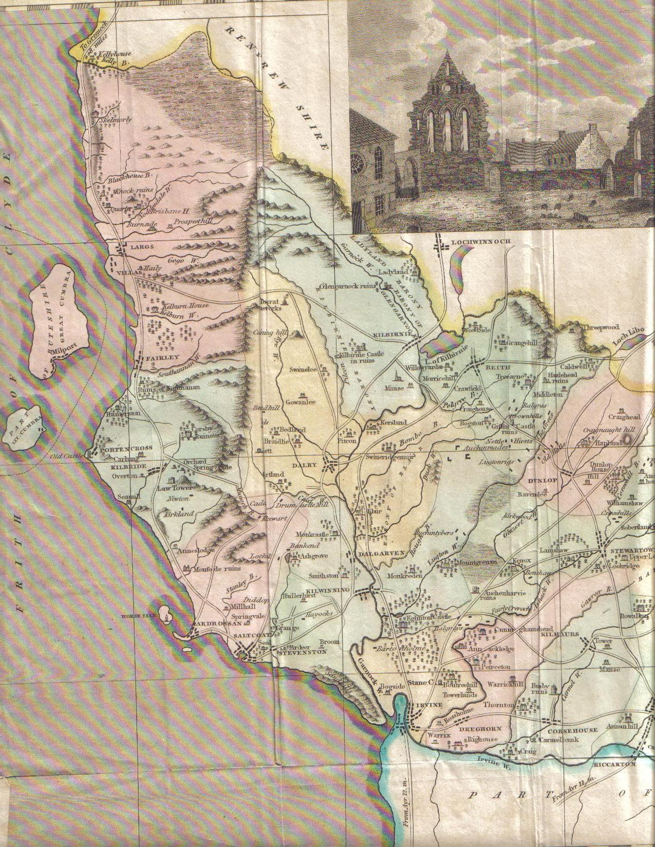
19th Century map of Cunninghame
Images
Added by: Places That We Know
01 Apr. 2020
Published in public domain under Creative Commons Attribution ShareAlike 4.0 International license
Map of Cunninghame from the early 19th Century, as drawn by James Robertson (1753-1829). The colours on the map relate to the different parish areas, and inset is a engraving of Kilwinning Abbey's ruins.
Across Garnock Connections area
built
natural
social